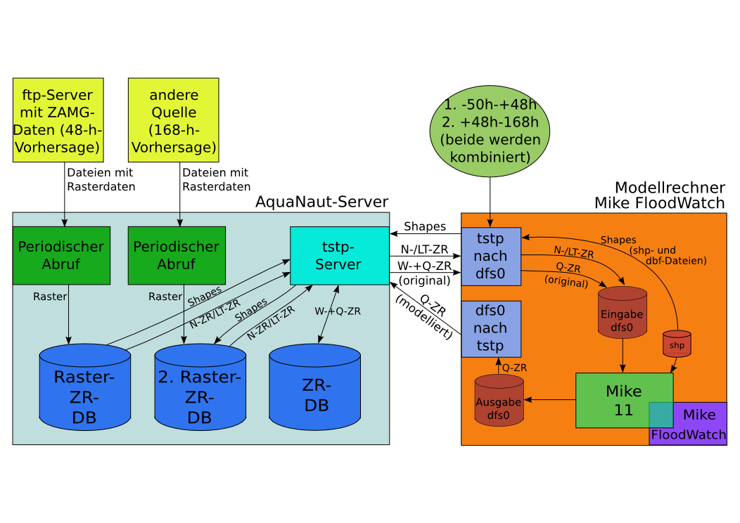
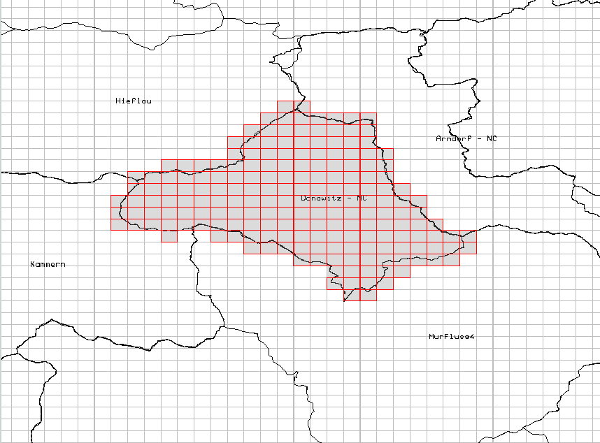
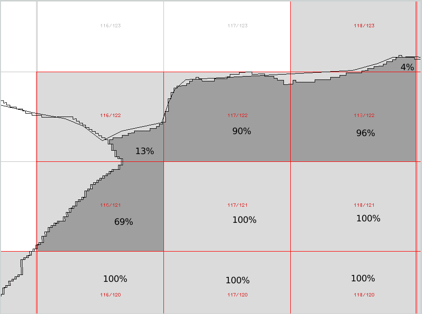
A request to the raster-time-series database is made via the TSTP server. To this effect, a set of polygons (i.e., areas such as subcatchments or field blocks) are transmitted in the form of a shape file. Picture 2 shows such a polygon. The polygons are blended with the tiles. One weight is calculated for the tiles blended along the edge (see next picture 3). So filtered tiles are averaged including their weight. Then, over the desired period, the values \u200b\u200bare determined for all tiles. The values \u200b\u200bare stored in the raster-time-series database so that this request can be processed quickly. Therefore, no rasters are stored in the raster-time-series database. It is not intended that rasters from a raster-time-series database are generated.
RastIO
RastIO is a network service that provides read and write access to raster databases via a REST-protocol. The exchange format used is the GeoTIFF format standardized for the WCS (web coverage service). In addition to grids, pictures in PNG format can also be read.
- Read in the grid quickly
- Output time series quickly
- Long-term archiving
- Dynamic access
- Geometrically accurate evaluation. Not point-oriented, but tile-oriented
- Linking different rasters of different tile sizes
- Input formats: Grib, Grib2, NetCDF, ZAMG, Radolan
- Multi-parameter raster (e.g., ensemble data)
- Connection to TSTP. Control via shape. Merging with time series
- Special transformations: rotated pole, polar stereographic projection
- Individually customizable, e.g., Polar coordinates, other input formats
 +49 241 92 78 92-0
  post@toposoft.de