We have developed the raster-time-series database in order to obtain time-series data from raster data with high performance, and therefore optimized it for high data throughput. For example, you can obtain area precipitation directly from the database, and you do not have to calculate the values in an extra step ahead of time. Using Kriging (OK) or IDW, you can project your selected time series from the time series database onto a regular grid, generating data for a raster-time-series database (for example, to compare with radar data).
RastIO
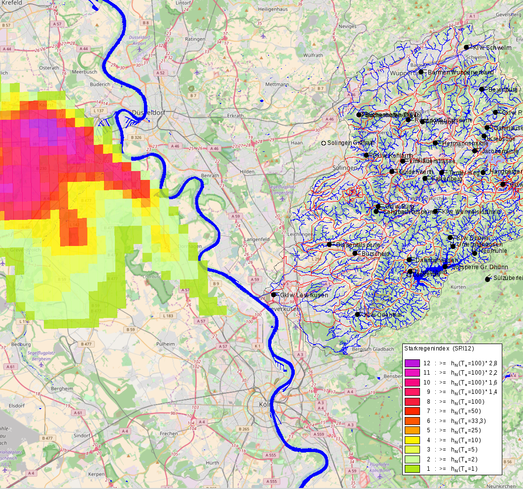
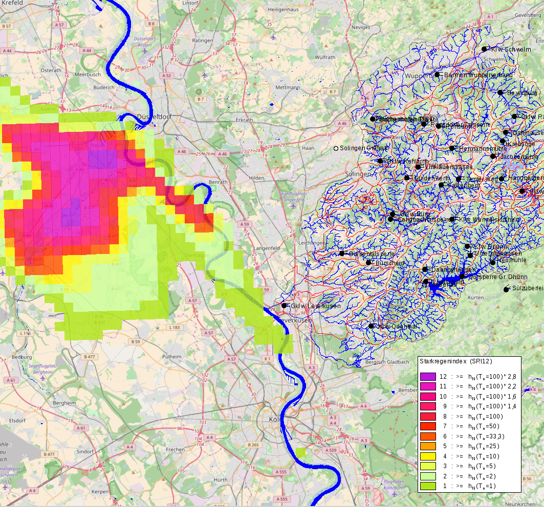
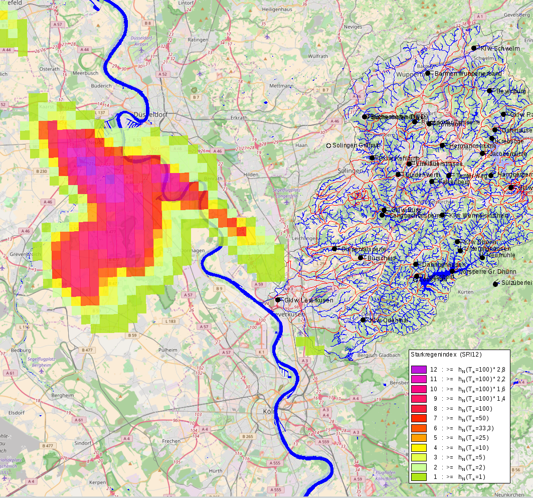
RastIO is a toposoft service that imports and exports grids and can be used to create raster images. Import and export are handled by the GeoTIFF format. The entire grid is exported using the Multi-GeoTIFF format. Images for the web are offered as PNG. RastIO can also deliver aggregated rasters. In this way you can, for example, make daily totals or annual maxima available - either as an end product on the Web or for automatic input data, e.g., for models.
 +49 241 92 78 92-0
  post@toposoft.de